Lasers and AI Enhance Safety, Service Reliability
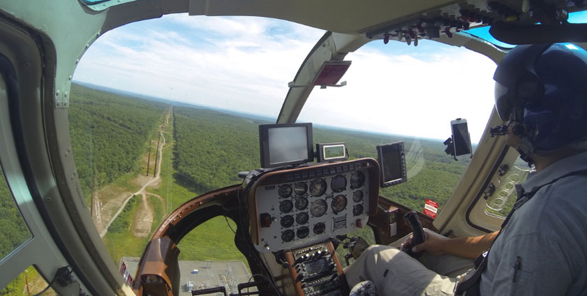
LiDAR data is gathered along FirstEnergy transmission rights-of-way by a helicopter with equipment provided by partner GeoDigital International, Inc.
October 23, 2020
Combine Light Detection and Ranging (LiDAR) with artificial intelligence (AI) analytic methods and what do you get? New, innovative tools for assessing conditions along our transmission line rights-of-way (ROW).
“We’re beginning to use these advanced technologies to more safely and efficiently identify areas where our rights-of-way may need attention – from spotting dead tree hazards to identifying areas where aerial saws are best used,” said Becky Spach, director, Vegetation Management. “These techniques hold great promise to enhance safety for vegetation management personnel, reduce the potential for human errors, promote better adherence to vegetation management standards and, as a result, help eliminate tree-related outages.”
These technologies also are being used to validate that completed transmission line work meets design requirements. According to Chrissy Todd, general manager, Transmission Operations Support: “We’re developing a post-construction, as-built verification process that leverages the data collected by the Vegetation Management LiDAR program. When we combine LiDAR data with advanced AI analytics tools, we gain the ability to enhance our business intelligence with digital data and streamline manual processes through automation.”
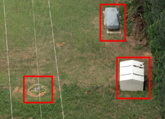
LiDAR technology consists of a laser and GPS receiver. About the size of a large soup can, the device can be easily positioned on a tripod or mounted to a helicopter to capture detailed scans of almost any environment. As a laser bounces light beams off objects around it, the device captures and saves all the reflected points within a selected range. This data can be downloaded to a computer as a three-dimensional record and configured into an image that can be rotated and viewed from any angle desired. In addition, the distance between two points within the image can be measured very accurately.
AI is the simulation of human intelligence in machines, including traits such as learning and problem-solving. By applying AI to LiDAR scan data, systems can be designed to look for and call attention to specific situations that may indicate a problem. Examples include vegetation that has grown too close to a transmission line or to validate that construction meets design requirements. Once the LiDAR data has been gathered, AI can quickly flag those specific situations for further investigation before a decision is made on how best to proceed.
Other uses being investigated for LiDAR and AI include identifying man-made ROW encroachments, especially new ones appearing since a previous survey, and verifying clearances where transmission lines cross, which should be particularly helpful in ensuring safety for aerial survey crews. These technologies also hold promise for assisting storm restoration efforts.
Becky praised the collaboration between business units that continually identifies cross-functional uses for the LiDAR data acquired each year by the team led by Shawn Standish, manager, Vegetation Program Management. “The team is working closely with Transmission’s Engineering, Design, Mapping, Line Maintenance and Surveying organizations – as well as FirstEnergy Flight Operations – to fully leverage this promising technology across our service territories,” she said.