Over the River and Through the Woods
The Mutual Assistance App will soon be available for FEU crews to use when they travel.
December 11, 2020
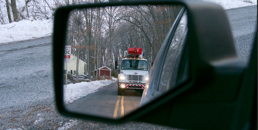
Driving through an unfamiliar area can be stressful, especially when you are focused on helping restore service to customers. You don’t know where to eat or get gas for your vehicle. To help ensure a smoother trip, there is a new app being developed to assist line crews and other utility workers in this type of situation.
The Mutual Assistance App can show traveling line crews where all the rest stops, restaurants, gas stations and other important places – like hospitals and pharmacies – are located along their journey. It also displays weather and radar information. The best part of the app is that all of this information can be displayed in one view.
Several FirstEnergy supervisors tested the app in August while providing mutual assistance in the wake of Hurricane Laura. They were pleased with the results.
“After using the app a few times, employees will wonder how they ever traveled without it,” said Dave Hillanbrand, manager, Emergency Preparedness, with a chuckle. “The software is still under development – with plans to add features like displaying the height and weight restrictions of bridges and tunnels that are located along a route. There are few things worse than having to backtrack 10 miles because you encountered a bridge that didn’t have the appropriate weight standard for one of our bucket trucks.”
According to Dave, the Mutual Assistance App is similar to the Global Positioning Systems (GPS) many people use when they travel – but with a few extra features.
“In addition to functioning like a traditional GPS device, the app can show details like the level of COVID-19 cases in an area,” explained Dave. “Counties on the map are outlined in various colors – with red representing a high level of COVID-19 and white a low level – so line crews can decide if they want to stop where they are or travel a few counties over. In today’s environment, this is crucial information.”
The app also has a map function that can give the user an aerial view of a location. “Having that view can help determine if a restaurant’s parking lot is large enough to accommodate several large utility trucks,” continued Dave. “Again, very useful information to have for traveling line crews in unfamiliar areas.”
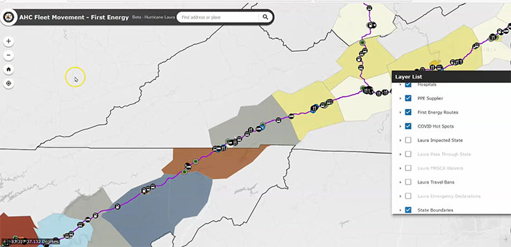
In addition to highlighting the driving route, the app uses a series of symbols to denote restaurants, gas stations and other facilities.
In addition to highlighting the driving route, the app uses a series of symbols to denote restaurants, gas stations and other facilities.
The Mutual Assistance App is being developed by the Sensitive Information Sharing Exchange (SISE) and was originally created as a tool to use during COVID-19. The group’s goal is to find ways to help government agencies and private companies operate during extreme events, such as pandemics and major storms. Since FirstEnergy is a member of the organization, our employees have access to the app.
All of the features on the app can be toggled on or off, depending on the user’s preference. Another useful tool is the optional tracking system that notifies the company that crews arrived at their destinations safely.
After the recent supervisor testing, FirstEnergy submitted suggestions to enhance the functionality of the app, which the SISE – a non-profit financially supported by the U.S. Department of Homeland Security – has already reviewed and will soon implement.
“The app is currently available to all company supervisors and will be available soon for crews to use when they travel,” Dave added.